MAPTATVA / PRODUCT GUIDE
Online GIS Software for Survey Data
Bring imagery, terrain, vector layers and drawings into one survey project. Maptatva is online GIS software built by Hemadri Geospatial in Pune for surveyors, project teams and students working with real field data.
Explore the Maptatva platform →
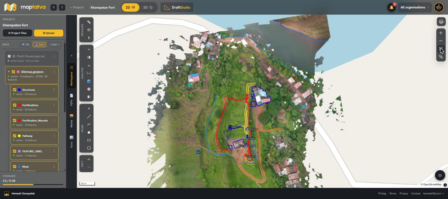
Work with your survey layers
Open GeoTIFF orthomosaics, terrain models, shapefiles, KML, GeoJSON and CAD data. Keep features on separate layers and edit attributes in a table. The map loads the visible imagery rather than requiring a complete raster download before you can start viewing.
Measure terrain and compare visits
Measure distances and areas, generate contours and elevation profiles, and calculate cut and fill against a chosen base. Assign dates to survey layers to compare the same site across visits. Terrain analysis depends on the source elevation data and its coordinate system.
Share results with clients
Keep the survey in one project and send a read-only viewing link. Clients can review shared work without creating an account; team access can be limited to specific projects. Use the browser workflow to review information together instead of circulating separate copies of every dataset.
Learn GIS using field data
Students and institutes can use imagery, terrain and vector layers for practical GIS exercises, fieldwork and assignments. Explore the available plans and student eligibility on the pricing page. Browser performance depends on the device, connection and dataset size.