MAPTATVA / PRODUCT GUIDE
Cloud Photogrammetry & Drone Image Processing
Turn drone imagery into survey outputs and continue working with them in the same browser-based platform. Maptatva connects cloud photogrammetry with GIS analysis, 3D viewing, drafting and project sharing.
Explore the Maptatva platform →
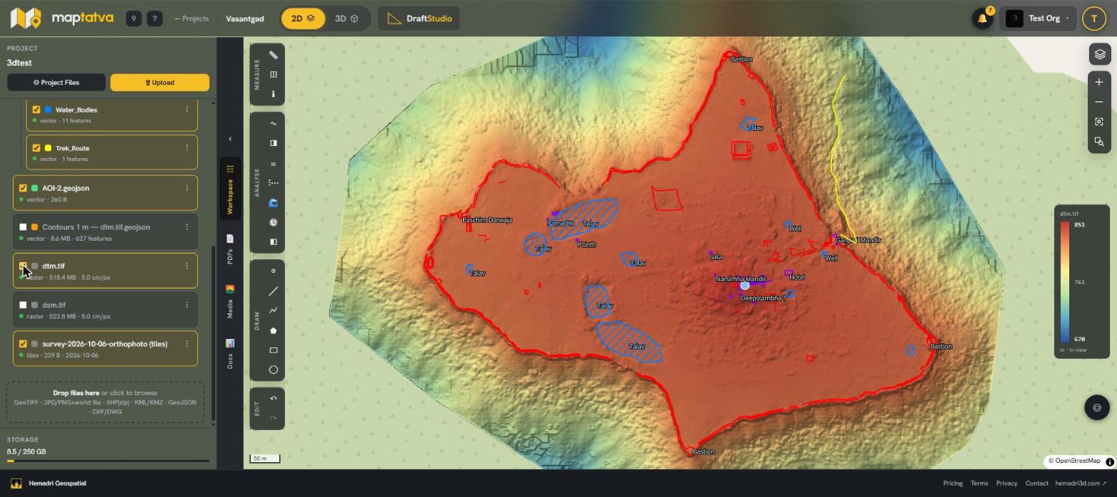
From photographs to survey outputs
Upload imagery to a project and use cloud processing to create orthomosaics, terrain and 3D models. Large uploads can resume after a connection interruption. Processing runs in the cloud, while the browser provides access to the project and its outputs.
Plan the capture before processing
Image overlap, camera quality, lighting and the control used during capture affect the result. Cloud processing does not replace suitable field methods or independent accuracy checks. Choose the capture approach and outputs for the survey's actual requirements.
Use the result beyond a download
Open processed imagery and terrain alongside survey layers. Generate contours and profiles, review changes across survey dates, and use the 3D model for visual inspection. Draft Studio can prepare measured views and drawing sheets from a model.
Choose a plan with processing
Cloud processing availability differs by plan. Check the current pricing and limits before selecting a subscription. A new individual account starts with a 30-day Pro trial and a new organisation with a Team trial, each with 5 GB of trial storage.